Nereson Impoundment
About the Nereson Impoundment
This project was constructed in the early 1980's to provide both flood control and wildlife management. The project, consisting of dike construction and an outlet structure, was a cooperative effort between the District, the Minnesota DNR, and Roseau County, and was designed to provide wildlife benefits as well as flood control. The impoundment controls flood water from a 16 square mile area along State Ditch #91, and is located in Nereson Township of Roseau County.
This impoundment consists of a main impoundment, constructed in the 1980s, and a sub impoundment, constructed in the 1990's. It is located approximately 10 miles southeast of the City of Greenbush on the Nereson Wildlife Management Area, on land owned by the MN DNR. Construction was funded by the State of Minnesota, the Red
River Watershed Management Board, and the Two Rivers Watershed District. Project sponsors are the TRWD, DNR, and Roseau County.
The impoundment includes three water control structures, two emergency spillways, over 5 miles of dikes, and various inlet structures. The total surface water area when full to the emergency spillway covers over 1,500 acres. The impoundment will store 3,500 acre feet when full, and controls up to 4.1" of runoff from an upstream drainage area of over 16 square miles.
Local benefits include flood reduction on state ditch #91, the South Branch Two Rivers, Lake Bronson, and further downstream on the Red River. The control structures are operated by the MN DNR in close consultation with the TRWD. The impoundment is a dual purpose, with a wildlife conservation pool maintained year around, with a flood pool able to be used during times of flooding.
For a printable copy of the assessment area map, click here.
Photo Gallery
.jpg)
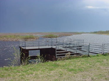
The outlet structure at the main pool of the Nereson Impoundment
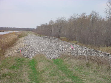
The emergency spillway for the Nereson Impoundment